Fly Smarter.Every Flight.
Weather intelligence, live GPS tracking, zone alerts, competition task sheets, crew coordination — everything a balloon pilot needs in one app.
Sign up on the web to start your free trial. No charge for 30 days.
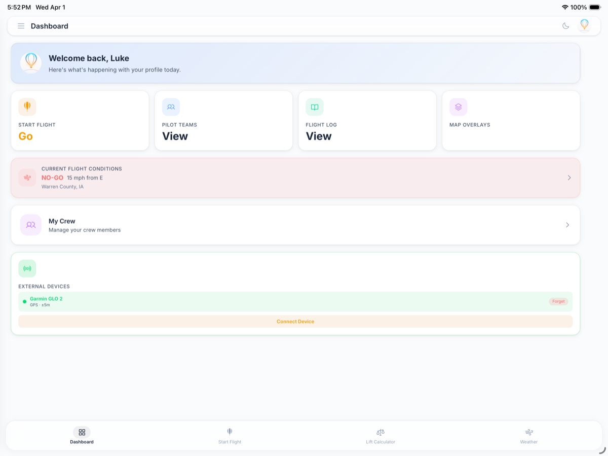
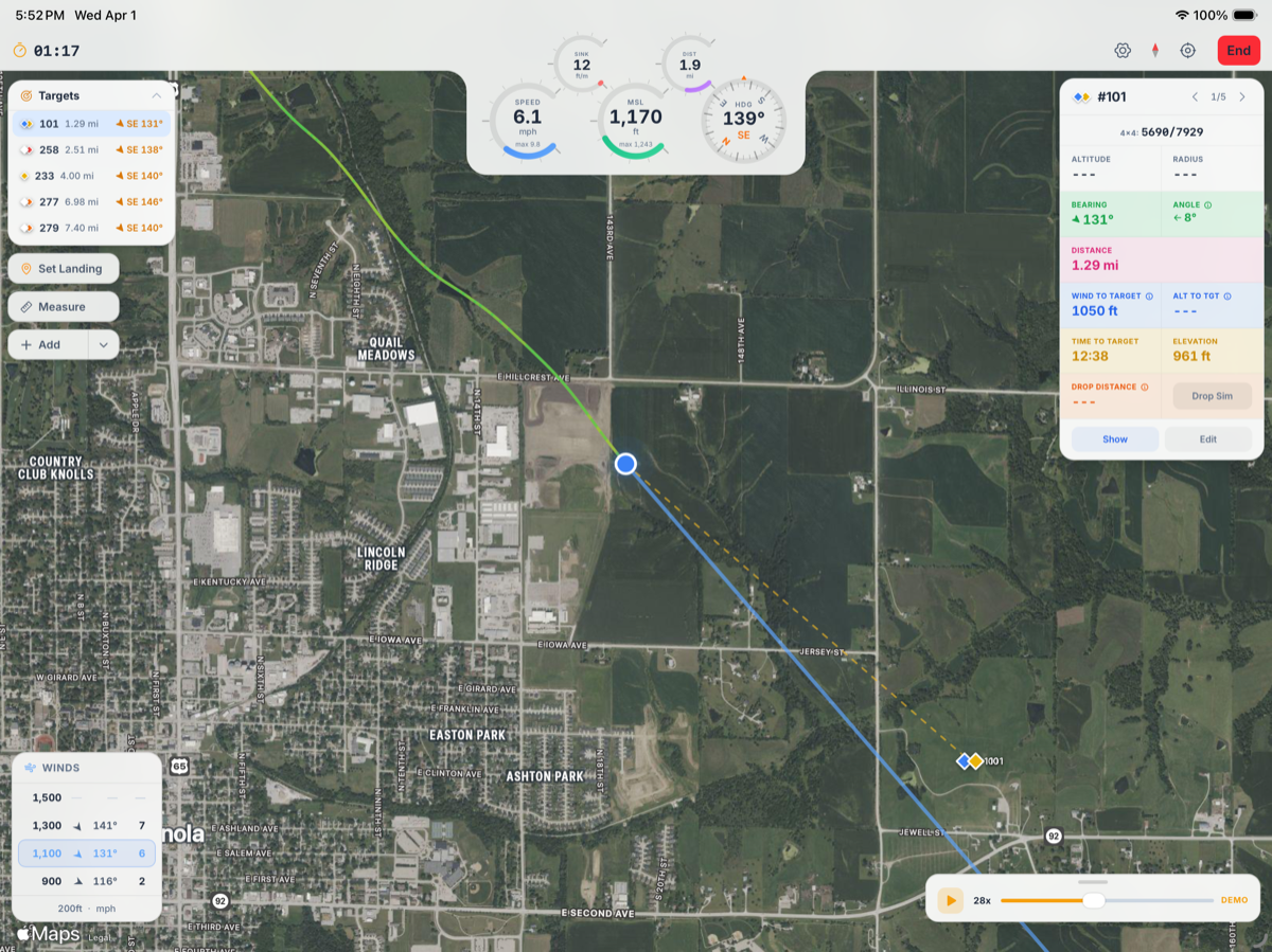
Live In-Flight
Your cockpit, digitized.
Real-time GPS tracking with a full HUD — altitude (MSL & AGL), speed, heading, vertical rate, and a live flight track on the map. Your crew sees your position every second.
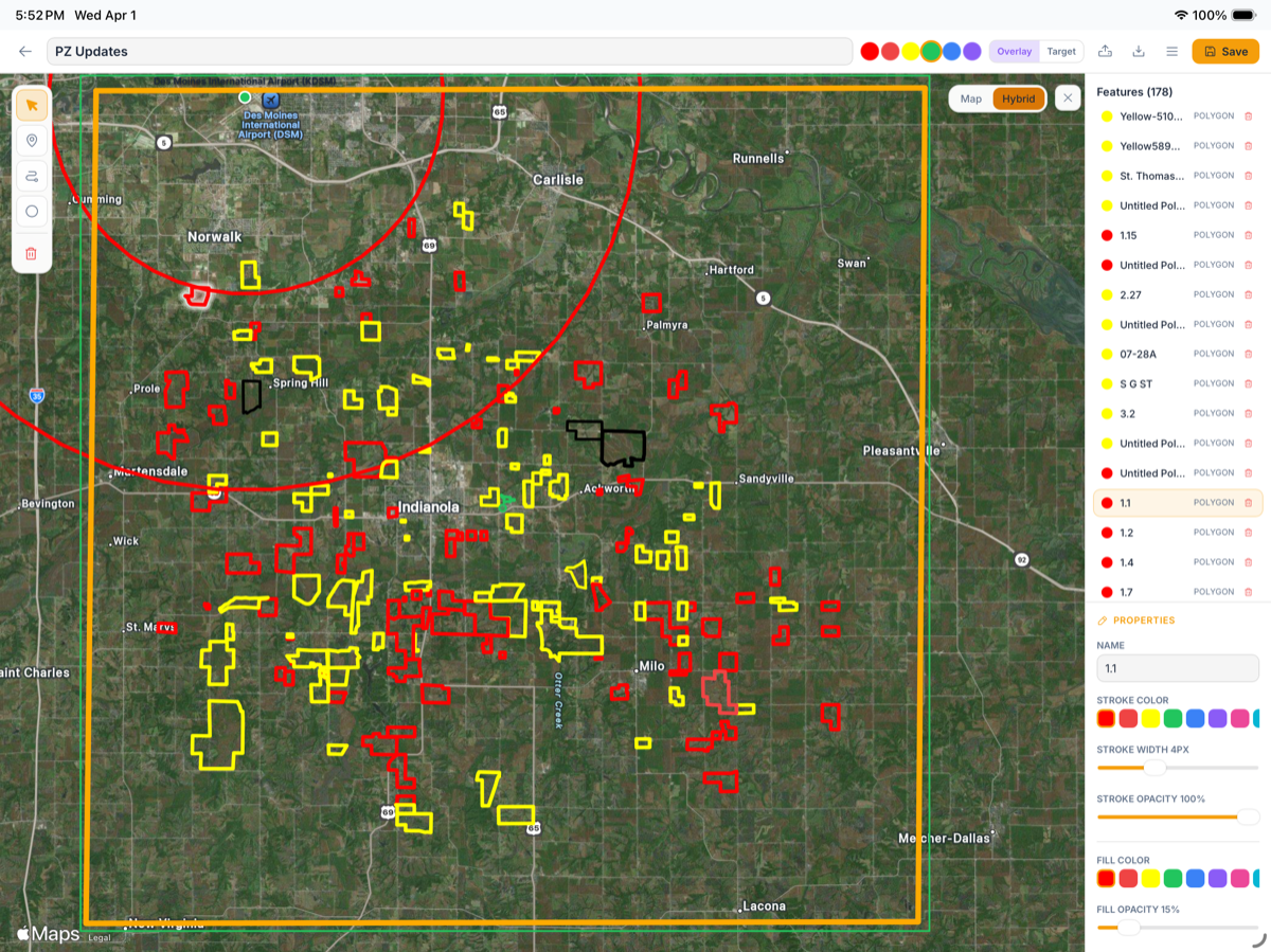
Overlay Editor
Build & import overlays.
Draw polygons, lines, circles, and points directly on the map. Import and export KML, GeoJSON, and GPX files. Save once — it syncs to all your devices.
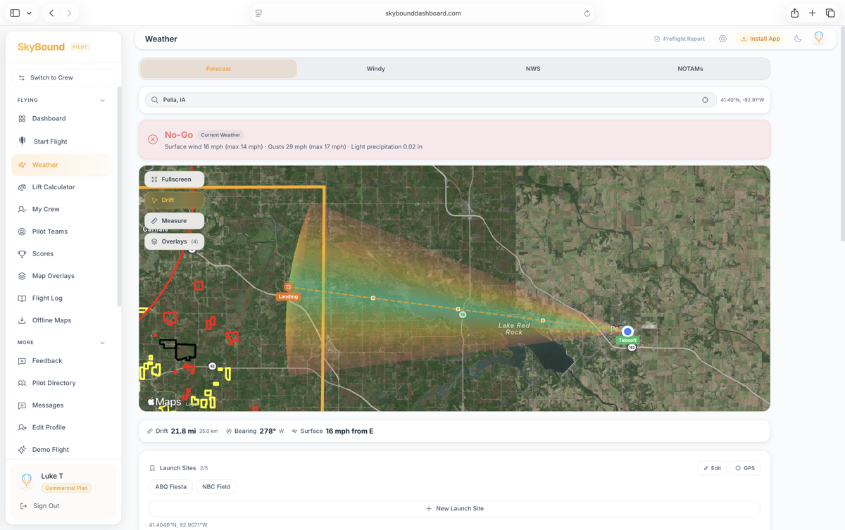
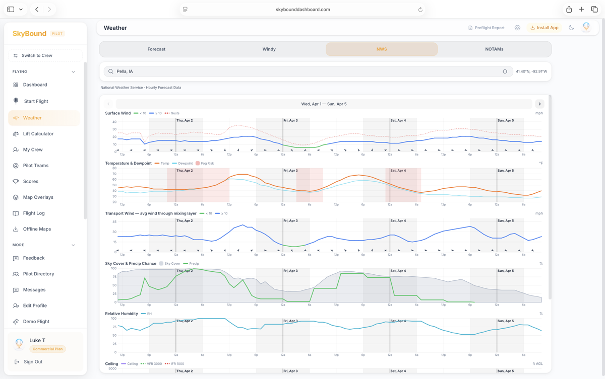
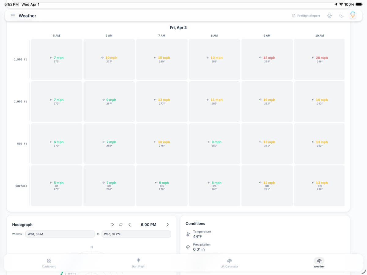
Weather Intelligence
Know before you go.
Flight-specific forecasts with wind speed at multiple altitudes, surface conditions, and pibal-style wind profiles. Know exactly when conditions are flyable.
Flight Tools
Built for the Way You Fly
From pre-flight weather checks to live in-flight tracking and post-flight analysis — everything a balloon pilot needs, in one app.
Weather Intelligence
Flight-specific weather forecasts with wind speed at multiple altitudes, surface conditions, and pibal-style wind profiles. Know exactly when conditions are flyable.
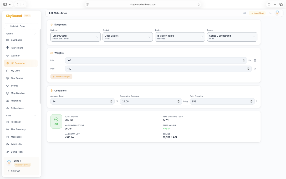
Lift Calculator
Calculate your balloon's lifting capacity based on envelope volume, temperature, altitude, and payload weight. Know your performance margins before you launch.
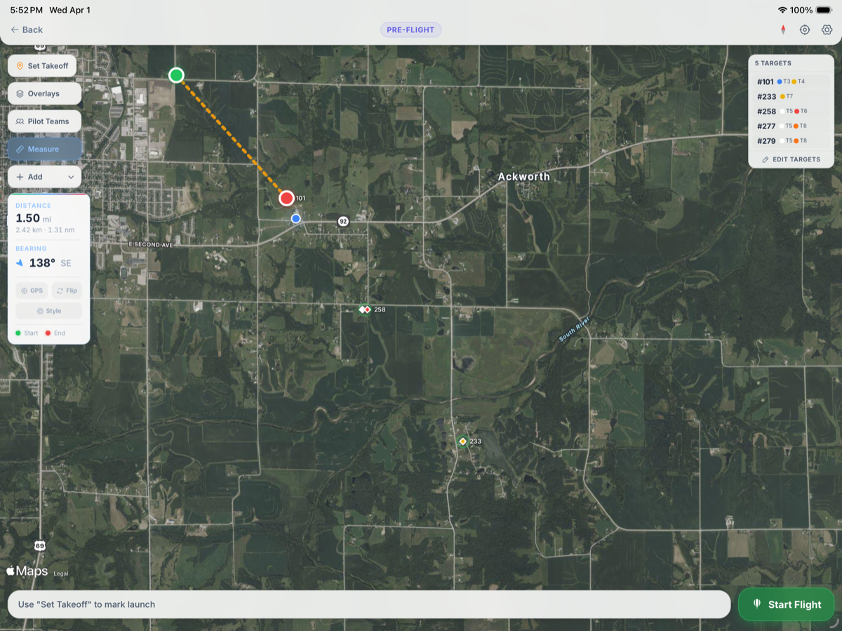
Flight Planning
Plan your flights with interactive maps, set landing targets, and import KML/GPX overlays for zone boundaries and competition targets. Full pre-flight preparation in one place.
Live In-Flight Tracking
Real-time GPS tracking with a full HUD — MSL and AGL altitude, speed, heading, vertical speed, and a live flight track on the map. Your crew sees your position in real time.
Zone Proximity Alerts
Import your zone overlays and set altitude rules per zone color. Get audio and haptic alerts when approaching restricted zones, descending in no-landing areas, or dropping below altitude floors.
Competition Task Sheets
Snap a photo or upload your task sheet and AI automatically extracts tasks, targets, colors, and scoring details. In-flight HUD guides you through each task with bearing, distance, and real-time scoring analysis.
Overlay Editor & Creator
Build overlays from scratch or import KML, GeoJSON, and GPX files. Draw polygons, lines, circles, and points directly on the map. Export to any format. Everything syncs across all your devices — create on your computer, fly with it on your iPad.
Teams & Crew
Create teams with fellow pilots and crew. Your position, speed, altitude, and planned landing spot broadcast every second so crew always knows where you are. Crew gets in-app navigation to your landing spot for seamless retrieval. When multiple pilots on the same team fly together, see everyone's live tracks, projection lines, speed, and altitude on one map.
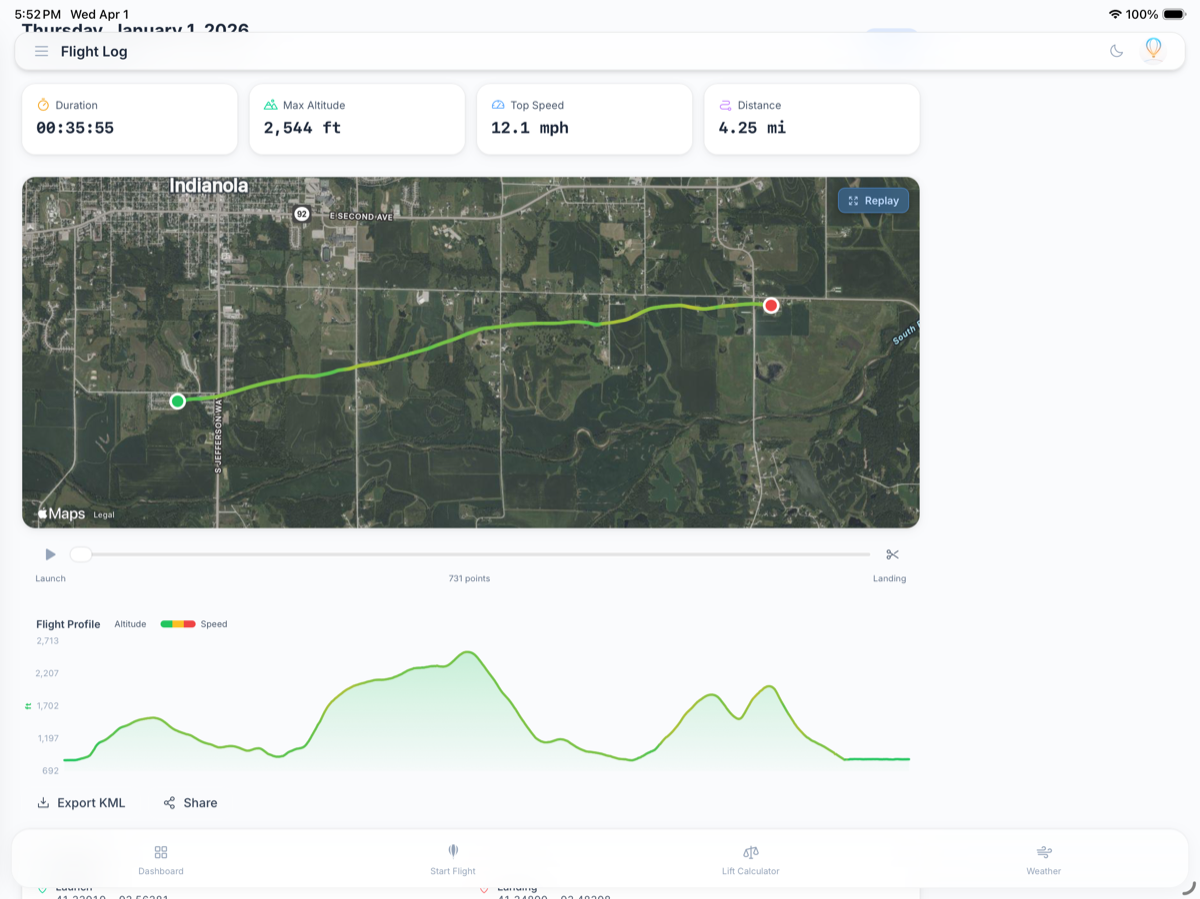
Flight Log & Replay
Every flight is automatically logged with full GPS tracks, stats, and altitude profiles. Replay your flights on the map and share them with your team.
Pricing
Flight Plan
Everything you need to fly smarter.
For recreational, private & competition pilots
- Weather intelligence & wind profiles
- Lift calculator
- Flight planning with interactive maps
- Live in-flight GPS tracking & HUD
- MSL & AGL altitude readouts
- Zone proximity alerts with audio & haptic
- Map overlay editor & creator (KML, GeoJSON, GPX)
- Import & export any overlay format
- Competition task sheet analysis (AI)
- Pilot teams & crew teams
- Real-time crew tracking & navigation
- Flight log with GPS replay
- Pilot-to-pilot messaging
- Pilot directory access
- SkyBound Assistant (AI)
- Quick-link embedded scores
- Syncs across all your devices
Free for customers — always. All plans cancel anytime.